Chapter 1
How high water reaches a house
The questionWhere does flood water come from here, and how high can it get at my house?
The short answerHigh water reaches a Wharton County house in two ways: a river, creek or slough leaves its banks, or heavy rain falls faster than the ditches and storm drains can carry it off.
By the editors of High Water at Home · Updated · about 7 minutes

Sections in this chapter
- 1.1 Where does the water come from?
- 1.2 What does the river gauge at Wharton measure?
- 1.3 What happens at each river stage in Wharton?
- 1.4 How high has the Colorado crested at Wharton?
- 1.5 Is rain flooding different from river flooding?
- 1.6 How does the water climb into a house?
- 1.7 What can you note down before the next rise?
1.1 Where does the water come from?
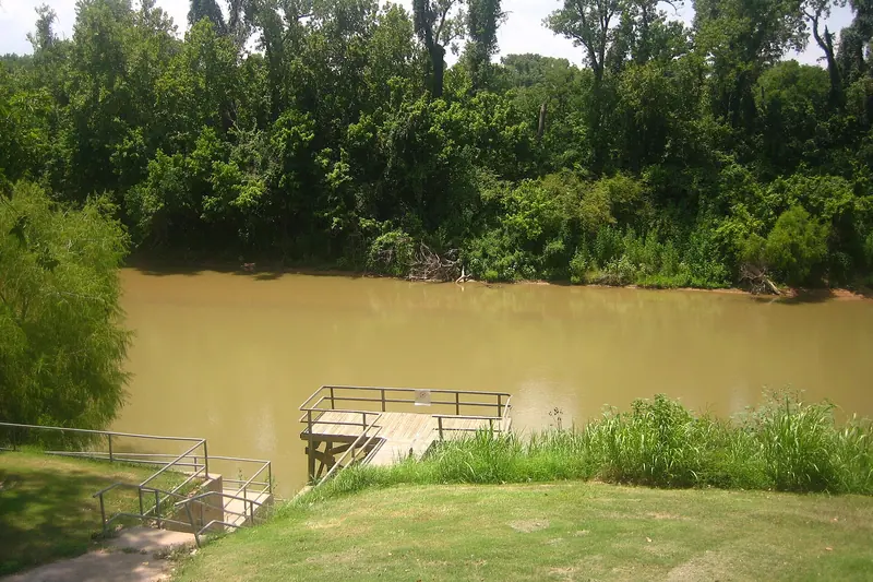
The Army Corps of Engineers lists four sources of flooding for the town itself, in a USACE presentation to the city dated 19 April 2022: the Colorado, plus Caney Creek, Peach Creek and Baughman Slough. Out in the county, the San Bernard River runs past East Bernard and Boling, and East Mustang Creek runs near Louise. Each one rises on its own clock, so a calm Colorado does not promise a dry yard.
Rain is the fifth source, and it needs no river at all. After the 2020 storms, Corps project managers saw water marks four feet above the ground in Wharton neighborhoods, nearly 25 feet above normal river levels, as the U.S. Army reported on 21 March 2023. That was rain the ditches could not move fast enough.
1.2 What does the river gauge at Wharton measure?
The gauge measures how high the river stands above a fixed zero point, not how deep the water is in anyone's yard. The National Weather Service gauge WHAT2, Colorado River at Wharton, shares its site with USGS station 08162000, and its zero sits at 52.42 feet on the older NGVD29 survey datum. A reading of 43 feet means the water surface is 43 feet above that zero. Your lot may sit well above or below the bank beside the gauge.
NWS sets four levels on each gauge (Table 1.1). Action stage is a cue for agencies to get ready. Minor, moderate and major describe what the river does to land, roads and buildings close by.
| Gauge | Action | Minor | Moderate | Major |
|---|---|---|---|---|
| Colorado River at Wharton (WHAT2) | 20 ft | 39 ft | 41 ft | 43 ft |
| San Bernard River at East Bernard (EBBT2) | 13 ft | 17 ft | 23 ft | 28 ft |
| San Bernard River near Boling (BOLT2) | 14 ft | 18 ft | 22 ft | 32 ft |
| East Mustang Creek near Louise (LMCT2) | 10 ft | 19 ft | 22 ft | 25 ft |
1.3 What happens at each river stage in Wharton?
NWS publishes short impact statements that tie the Wharton reading to streets and homes. At 39 feet, minor lowland flooding begins as water escapes the main channel. At 43 feet, the lowest homes are threatened and many streets on the west and southwest sides of town flood. At 45.3 feet, many homes in the west part of town hold 2 to 3 feet of water. At 48 feet, most streets between Sunset Street, FM 102 and U.S. Highway 59 are impassable, and several homes have 3 feet or more inside.
Those statements are the nearest thing to an official ruler for the town. They carry no date and describe past floods, so treat them as a pattern, not a forecast for your street.
1.4 How high has the Colorado crested at Wharton?
The highest crest NWS lists is 50.47 feet on 31 Aug 2017, during Hurricane Harvey, which is 7.47 feet above major flood stage. Five of the top crests on the Wharton gauge record fall between 1998 and 2017 (Table 1.2).
| Date | Crest | Event noted by NWS |
|---|---|---|
| 31 Aug 2017 | 50.47 ft | Hurricane Harvey, record |
| 3 Jul 1940 | 48.99 ft | Flow of 100,000 cfs |
| 23 Oct 1998 | 48.72 ft | October 1998 flood |
| 26 Nov 2004 | 48.32 ft | November 2004 flood |
| April 2016 | 48.30 ft | Spring 2016 flood |
| 31 May 2016 | 47.00 ft | Second 2016 crest |
The other gauges keep their own records. The San Bernard reached 31.99 feet at East Bernard on 30 Aug 2017 and 43.79 feet near Boling on 31 Aug 2017. East Mustang Creek near Louise peaked at 24.35 feet on 21 Nov 2004. NWS has no gauge on Caney Creek or Peach Creek, so their rises do not show on the public gauge map.
1.5 Is rain flooding different from river flooding?
Rain flooding can arrive within hours while the river is still low. The same Army article says the Santa Fe ditch carries runoff for roughly one quarter of Wharton in a heavy storm, and when ditches and outfalls fall behind, water stands in streets and yards long before the Colorado climbs. River floods tend to build over days as water comes down from upstream; the Harvey crest reached the Bay City gauge two days after it passed Wharton.
Rain also fills the sewers. When street lines run full, sewage looks for the lowest open drain in the house, which the chapter on drain backups explains.
1.6 How does the water climb into a house?
Floodwater climbs in steps, and this book follows them. First it covers the yard, the wellhead, the septic lids and any outdoor gas or propane piping. Next it reaches the slab or the floor joists. Then it reaches outlet height, where wiring, water heaters and well controls live. Start with your lot's flood zone and what the levee work will and will not do, and keep the chapter on power that stays off close for anything that goes under.
1.7 What can you note down before the next rise?
Find the gauge nearest you and write down the reading at which your street, your yard and your floor last took water. Tape that note inside a kitchen cabinet with the date. When NWS forecasts a crest, compare the two numbers and decide early. Then set aside drinking water, as the chapter on storing water describes, in case the supply fails.
Questions readers ask
Does a 45-foot reading mean 45 feet of water on my street?
No. The number is the height of the river above the gauge's own zero point, which sits at 52.42 feet on an old survey datum. What it means for your street depends on your ground height, which is why the NWS impact statements are more useful than the raw number.
Where can you watch the river while it rises?
The NWS gauge page for the Colorado River at Wharton shows the current reading, the forecast crest and the flood categories. The San Bernard gauges at East Bernard and near Boling and the East Mustang Creek gauge near Louise have pages of their own.
Can my house flood when the Colorado is below flood stage?
Yes. Heavy rain, a full ditch or a backed-up storm drain can put water in a yard with the river far below 39 feet. The water marks the Corps saw after the 2020 storms came from rain, not the river.
Why is there no reading for Caney Creek or Peach Creek?
NWS lists no gauge on either creek in the Wharton area. Residents near them have to watch the water itself and local alerts, not a gauge number.
Did Harvey set the record on every gauge in the county?
Not all of them. Harvey set the top crest at Wharton, East Bernard and Boling in late August 2017, but East Mustang Creek near Louise peaked higher in November 2004.
What this chapter rests on
This chapter rests on the National Weather Service gauge records for Wharton, East Bernard, Boling and Louise as they read on 11 Nov 2026, the Corps' April 2022 presentation to the city, the City of Wharton's levee page and a March 2023 Army article. Gauge impact statements carry no date. Crest figures come from the NWS record alone; the USGS peak-flow record for the station is not used here.
Notes to chapter 1
- NOAA/NWS National Water Prediction Service — Colorado River at Wharton (WHAT2) · flood categories, crests, impact statements, gauge datum (data feed at api.water.noaa.gov/nwps/v1/gauges/WHAT2) · checked 11 Nov 2026
- NOAA/NWS — San Bernard River at East Bernard (EBBT2) · flood categories and 2017 record crest · checked 11 Nov 2026
- NOAA/NWS — San Bernard River near Boling (BOLT2) · flood categories and 2017 record crest · checked 11 Nov 2026
- NOAA/NWS — East Mustang Creek near Louise (LMCT2) · flood categories and 2004 record crest · checked 11 Nov 2026
- NOAA/NWS — Colorado River near Bay City (BACT2) · Harvey crest timing downstream · checked 11 Nov 2026
- USACE — City of Wharton Levee Lunch and Learn, 19 April 2022 · four flooding sources for Wharton · checked 11 Nov 2026
- City of Wharton — Wharton Flood Reduction Project, Levee · share of the city in the 100-year floodplain · checked 11 Nov 2026
- U.S. Army — Corps of Engineers work to mitigate flood risk for Wharton, Texas · 2020 rain water marks, Santa Fe ditch drainage · checked 11 Nov 2026
- Ready.gov — Floods · moving-water depths · checked 11 Nov 2026